
Coolfree Mountain [Sliabh Chuil Fhraoigh]
Good walks are even better shared.
Overview
Coolfree Mountain [Sliabh Chuil Fhraoigh]
Nestled in the heart of the Slieve Bloom Mountains, Coolfree Mountain, or Sliabh Chuil Fhraoigh, rises to an elevation of 398 meters, making it a popular choice among local hikers looking for a moderate challenge. This Marilyn is not just another bump on the landscape; it's a gateway to breathtaking views and rich geological history.
Geology
The mountain is primarily composed of Old Red Sandstone, which characterises much of the Slieve Bloom range. As you hike, take a moment to appreciate how this ancient rock provides insights into the Earth’s history, showcasing remnants of river systems and ancient environments that existed long before us. Talk about a rocky past!
Routes
The Lackeen Loop is a fantastic way to explore Coolfree Mountain. Spanning approximately 8 km, this moderate route can be tackled in about 3.5 hours. It takes you through vibrant greenery and past charming landscapes before leading you to the summit, ensuring a day well spent outdoors.
Summit Features
At the summit, expect a picturesque stone cairn and a trig point marking the highest spot. These features make for excellent photo opportunities—so make sure your phone is charged!
Terrain Type
The terrain can be described as grassy with rocky outcrops. While the views will have you on cloud nine, be wary of the odd bog patch that might try to steal your footing.
Views
From the top, you can savour sweeping sights of the Slieve Bloom Mountains’ undulating hills and verdant valleys. The best views are typically during spring and early autumn when the skies are clear, allowing for stunning photography opportunities and those magical moments of connection with nature.
Hazards
As with many mountainous terrains, Coolfree comes with its share of hazards. Be prepared for sudden changes in weather—Irish weather is known to be rather indecisive. Additionally, keep an eye on those rocks, which can be slippery when wet!
Nearby Summits
If you’re looking to extend your adventure, nearby Benbaun and Sliabh Bán offer enticing alternatives for those keen to stretch their legs further.
Access
Getting to Coolfree Mountain is a breeze. The nearest parking area is conveniently located along the R421 road, and for those using public transport, local buses connect you to the charming village of Kinnitty, not too far away.
Facilities
Once you’ve conquered the mountain, why not treat yourself in Kinnitty? The village boasts cafes, a grocery store, and essential public toilets, ensuring you’re all set before or after your hiking endeavours.
History
The name 'Sliabh Chuil Fhraoigh' translates to 'mountain of the hazel bushes'. This history is mirrored in the mountain’s natural beauty, where hazel trees hint at an eco-rich environment. The Slieve Bloom region also holds significant cultural importance, steeped in stories that link back to ancient Irish mythology.
Enjoy your adventure at Coolfree Mountain, where the views are as expansive as your spirit for adventure!
Explore routes near Coolfree Mountain [Sliabh Chuil Fhraoigh]
Public walks starting within 80 km of this hill. Nearby does not mean a route reaches the summit; check its map and access before setting out.
No public routes are currently listed within 80 km of Coolfree Mountain [Sliabh Chuil Fhraoigh] on Walkmates. This does not mean there are no paths here. Explore the map and check local access information before planning a walk.
Route planning notes
These notes describe possible approaches, not verified navigable routes or permission to cross land. Check current paths, local access rules and conditions before setting out.
Lackeen Loop
This moderate loop offers stunning views and is ideal for a half-day hike. Starting from a local trailhead, it winds through lush greenery before ascending to the summit.
Make a day of it, together
Find someone to share the walk with, or organise a day out along a route you like.
Hill facts and local notes
Classifications
Elevation
437m
1,433 ft
Prominence
128m
Coordinates
52.2955, -8.4799
R673160
OS Map
73
At the Summit
The summit features a stone cairn and a small trig point, both offering ideal photo opportunities as you stand atop this scenic hill.
Terrain & Geology
Coolfree Mountain is primarily composed of Old Red Sandstone, which is typical of the region. The varied geological layers tell a story of ancient river systems and shifting landscapes over millions of years.
Views & Scenery
On a clear day, the majestic sight of the surrounding Slieve Bloom Mountains and the broad valleys below will leave you breathless—though the summit air might assist with that!
History & Heritage
Name Origin
The name 'Sliabh Chuil Fhraoigh' translates to 'mountain of the hazel bushes', indicative of the natural flora that once dominated the area.
Historical Significance
The Slieve Bloom Mountains are steeped in Irish folklore and history, with ancient stories linking the land to Celtic mythology.
Getting There & Facilities
Check current local access restrictions, parking rules and transport timetables before travelling. These notes do not confirm public access to the summit.
Parking
There is a small parking area at the starting point on the R421 road, easily accessible for most vehicles.
Public Transport
Local buses run from nearby towns like Birr and Roscrea, but check the schedules, as they can be sparse.
Nearby Facilities
Kinnitty has several facilities including cafes, a grocery store, and public toilets. Perfect for a pre or post-hike refuel!
Safety Information
Known Hazards
- Watch out for sudden weather changes and slippery rocks, especially after rain; it’s not uncommon for the Irish weather to turn on a dime!
General Safety Tips
- Check weather conditions before setting out
- Carry appropriate clothing and equipment
- Let someone know your planned route
- Take a map, compass, and GPS device
- Carry emergency supplies: food, water, first aid kit, torch
Hills
Some common questions about the hills answered
Are there group walks up Coolfree Mountain [Sliabh Chuil Fhraoigh]?
Many walkers use Walkmates to join or organise walks with others. You can check for group walks around Coolfree Mountain [Sliabh Chuil Fhraoigh] through the maps
Are there other walkers around Coolfree Mountain [Sliabh Chuil Fhraoigh]?
Activity varies by location and time, but Walkmates lets you see whether others have shared walks or shown interest in this area. Find other people through the walking friends search walking friends for Coolfree Mountain [Sliabh Chuil Fhraoigh] search or of course create your own walk for Coolfree Mountain [Sliabh Chuil Fhraoigh]
Can I organise a walk to Coolfree Mountain [Sliabh Chuil Fhraoigh]?
Yes. If there aren’t any walks listed already, you can create a walk and make it available for others to join.
If you're signed up to Walkmates, you can create a walk to Coolfree Mountain [Sliabh Chuil Fhraoigh].
How do I find a walk up this hill?
There are often multiple ways to walk this hill, depending on experience and route preference. Walkmates helps you explore walks and routes that others have shared.
Can I suggest a new route up Coolfree Mountain [Sliabh Chuil Fhraoigh]?
Yes. You can suggest or create routes to share with others. Walkmates focuses on the social side of walking, so routes are used to help people organise walks and explore areas together, rather than as detailed navigation tools or route libraries.
Other uses really appreciate knowledgeable walkers sharing their routes. Share your favourite route to Coolfree Mountain [Sliabh Chuil Fhraoigh] here
The is an error or something incorrect about this hill. How do I let you know?
We always strive to keep the information on Walkmates as accurate as possible. If you find an error, please let us know through the contact form and we'll aim to correct it as quickly as possible
Community Discussion
Comments
Location
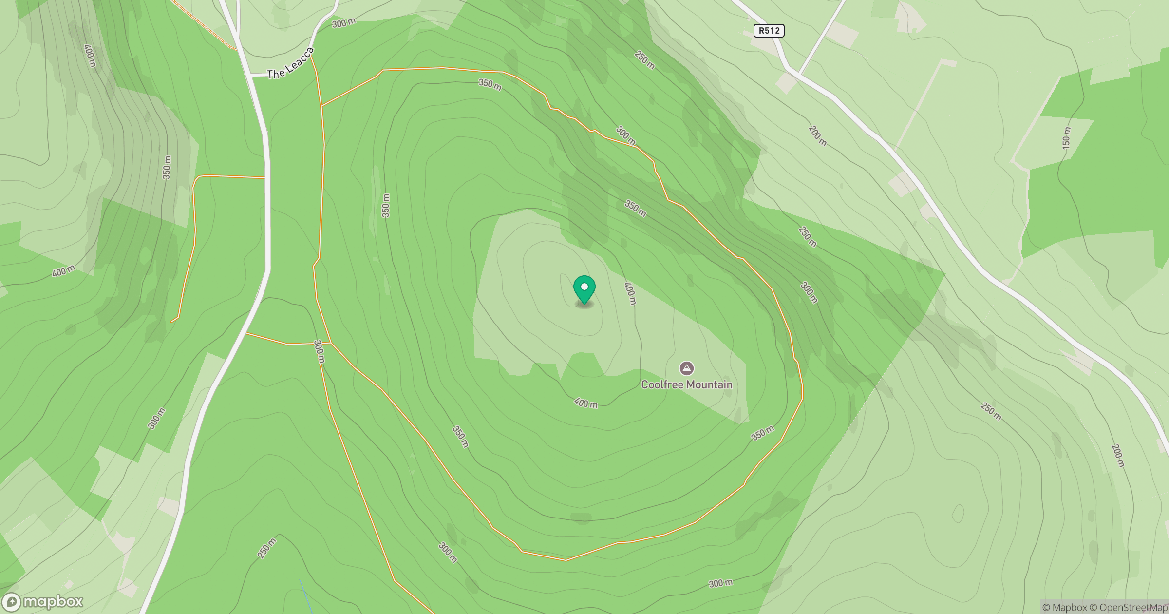
Grid reference: R673160
View on OpenStreetMapOpens a map in a new tab, centred on the hill.
Hills within 30 km
Straight-line distance, not a walking route or confirmation of access.
Galtymore [Cnoc Mor na nGaibhlte]
918m
Carrigeenamronety [Carraigin na mBrointe]
401m
Seefin Mountain W Top [Seefin Mountain] [Sui Finn]
528m
Fear Breagach
369m
Slievereagh [The Pinnacle] [An Sliabh Riabhach]
464m
No comments yet. Be the first.